The 10 Best Hikes in Virginia’s Shenandoah Valley

It’s not easy to pick a favorite hike among the myriad options in the Shenandoah Valley. But when I want to go on a hike, these 10 are the ones I turn to over and over again. They’ll challenge you in a number of ways, bring you to unique features and stunning views, and leave you with memories that you’re eager to share and repeat. I can’t wait to hike them all again.
Blackrock (1 mile)
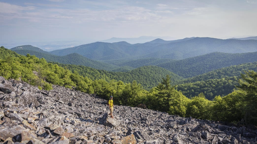
Clocking in at just one mile, there’s no excuse for not being able to squeeze in this hike. A relatively easy walk along the Appalachian Trail will bring you to one of the most striking features in Shenandoah National Park—Blackrock, an impressive talus slope with boulders aplenty to scramble up for even better views. The trailhead is located between mileposts 84 and 85 along Skyline Drive.
Bearfence (1.2 miles)

Bearfence may be short, but it is mighty—and a lot of fun. Famous for its rock scramble, you’ll find yourself using your hands and feet to pull yourself up and over each obstacle, all while taking time to enjoy the nearly 360 degree views of the area. You can find the trailhead between mileposts 56 and 57 along Skyline Drive.
Compton Peak (2.2 miles)
Want some geology with your views? The hike to Compton Peak will deliver both. Follow the Appalachian Trail from the parking area, located along Skyline Drive between mileposts 10 and 11. You’ll climb less than a mile and arrive at an intersection. Turn right for westerly views and left, to the east, for geology. The eastern trail leads you to a rock outcropping that is made of columnar basalt. Descend a bit to marvel at the unique shape of the rock.
Hawksbill Summit (2.8 miles)
Explore Shenandoah’s highest peak with this outing. You can access the trail from Skyline Drive at the Hawksbill Gap Parking Area, located between mileposts 45 and 46. Follow the blue blazes for the Lower Hawksbill Trail, and start climbing. A day-use shelter, Byrd’s Nest, yields good views at the top but the better ones are to be had at the viewing platform. Even better than the views: Your way back to the car is all downhill.
Duncan Knob (3.5 miles)

When the crowds are at Old Rag, you can have a rock scramble and vistas to yourself at Duncan Knob in the George Washington National Forest. The hike starts from the Gap Creek trailhead with an easy-enough-climb until you reach the turn to Duncan Knob and arrive at a jaw-dropping boulder field. Scramble up to the summit and find a good spot to check out views of Massanutten Mountain, the Blue Ridge Mountains, and Shenandoah Valley.
Big Schloss (4.1 miles) & Tibbet Knob (3.1 miles)

Either choice is an excellent one. Sister hikes Big Schloss and Tibbet Knob are both accessible from the Wolf Gap Recreation Area. Big Schloss is a bit longer and more popular, but the rock outcropping—named by German immigrants, it means castle—is a sight worth seeing. Tibbet Knob is shorter, but has two rock scrambles to make your hike to the vista an interesting one. Bring snacks. You’ll want to linger at the top for both.
Sky Meadows Summit (6 miles)

Sky Meadows State Park is unique among Shenandoah locations, giving you views of the graceful Piedmont region. You can string together various trails in the park to craft hikes of varying lengths. A good option is to take the South Ridge Trail to the North Ridge Trail, and then onto the Appalachian Trail. The Ambassador Whitehouse Trail will lead you back to the North Ridge Trail, but consider the detour onto the Piedmont Overlook Trail for a view of the historic Mount Bleak House as you make your way down.
Riprap (9.8 miles)
How about a swimming hole? This loop strings together the Appalachian Trail, Riprap Trail, and Wildcat Ridge Trail for an excellent—but tough—day in the park. You’ll get great views from Calvary Rocks and Chimney Rock before dropping down into a small gorge, where you can marvel at waterfalls and arrive at a deep swimming hole. Enjoy your time here, you’ll have to climb back up to the ridge to complete your hike. The trailhead is accessible from the RipRap Parking Area, just past milepost 90 on Skyline Drive.
Signal Knob (10.2 miles)
Full disclosure: Signal Knob in the George Washington National Forest is one of my favorite hikes. Is it the view from Signal Knob? The challenging climb? I can’t point to one reason, but I’ll go there in a heartbeat. Most hike it counterclockwise, but I believe clockwise is the better way: you start with a climb from the parking area along 678/Fort Valley Road, get great views and a good lunch spot in the middle at Signal Knob, and end with a (mostly) downhill route that yields even more good views. It’s a great hike for those looking to transition to longer miles.
Three Ridges (13.2 miles)
Now this is an epic hike. From the parking area on Route 56, it starts off with a five mile climb and rewards you with a few more climbs after that one. But those views are spectacular ones, and you’ll find yourself lingering to get just one more glimpse at the valley below. Most of the hike is along the Appalachian Trail, with a detour along the blue-blazed Mau-Har Trail to complete the loop.
Written by Jen Adach for RootsRated Media in partnership with Staunton.
Featured image provided by Robert Aberegg
View Events
Events happening throughout the Valley.
Explore Guides
How best to experience the Valley.
What’s New
Stay up to date by following our Blog.
